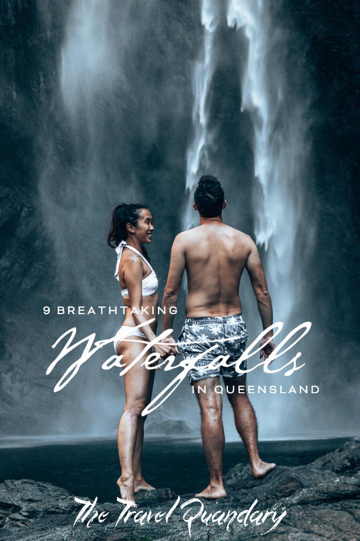
Sometimes we lose sight of how fortunate we are to have such spectacular landscapes right on our doorstep in Australia. Often, the most memorable day trips, weekend getaways or road trip adventures have been when we’ve been able to hop in the car, strap on our hiking boots and get the blood pumping to seek out the best waterfalls in Queensland.
We are so lucky to have waterfalls in the Brisbane area, waterfalls in the Gold Coast region and of course, the Cairns waterfall circuit. Being able to stand at the bottom of a waterfall and witnessing the cascading water in its unspoiled beauty and natural terrain will always make the heart skip a beat. The rhythm of the gushing flow, the water spray disappearing into thin air and often all in the middle of nowhere.
Here is a list of some of the easy-to-access waterfalls in Queensland. Many are located within National Parks and are completely free of charge under the care of QLD Parks. Please be a responsible hiker and remember to leave no unwanted and damaging traces behind.
We hope this post provides you with motivation to nourish your body with fresh air and movement or even to clear the cobwebs from your head. Happy waterfall hunting!

BEST WATERFALLS IN BRISBANE, GOLD COAST & NEAR CAIRNS
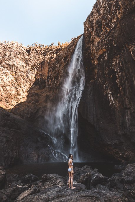
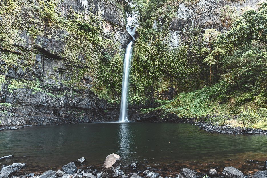
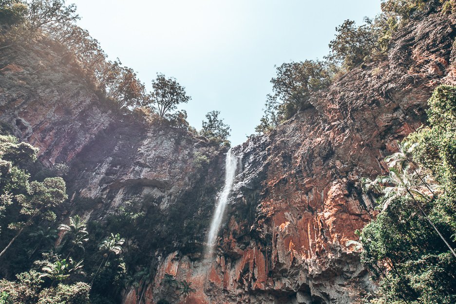
WALLAMAN FALLS
Australia’s highest, permanent single drop waterfall sits in the middle of Girringun National Park, 51 kilometres south-west of Ingham (approximately 1 hour drive). Measuring 268 metres high, Wallaman Falls is part of the UNESCO-listed Wet Tropics World Heritage Area. In our opinion, it’s one of the best waterfalls near Cairns. Viewing platforms are at the top of the lookout providing visitors with the perfect birds-eye view of this impressive cascading waterfall. If you want to go swimming in the pool at the bottom of the waterfall, you’ll need to trek 1.6 kilometres down a mostly unpaved, rocky trail. The track is rather steep in parts; hiking boots or closed in shoes are recommended. It is recommended to allow for 2 – 2.5 hours for the 3.2 kilometre return trip. Make sure to pack water!
Address
Girringun National Park, Lookout Rd, Wallaman QLD 4850
Distance
3.2 kilometres return
Time Required
2 – 2.5 hours return
Difficulty
Moderate
Extra info:
Wallaman Falls camping area is close by, adjacent to Stony Creek. Campers must reserve a spot online and pay their camping fees to obtain an e-camping permit. The camping area facilities include hybrid composting toilets, cold water shower, wood fire barbecues, picnic tables and a public pay phone.
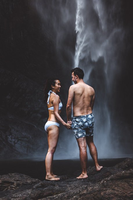
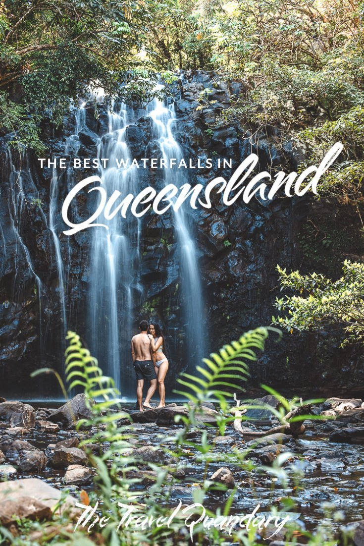
NANDROYA FALLS
Nandroya Falls is located in Wooroonooran National Park, off the Palmerston Highway between Innisfail and Millaa Millaa. Park your car at the Henrietta Creek camping area, cross the footbridge and begin your hike along the recently upgraded track under the leafy canopy. After about 700 metres into the rainforest, you’ll reach a fork in the road. The left hand fork is the shorter route, taking you past the 10m Silver Falls and up and down several gentle slopes. The right hand fork is the longer circuit route winding along Douglas Creek and past numerous rock pools.
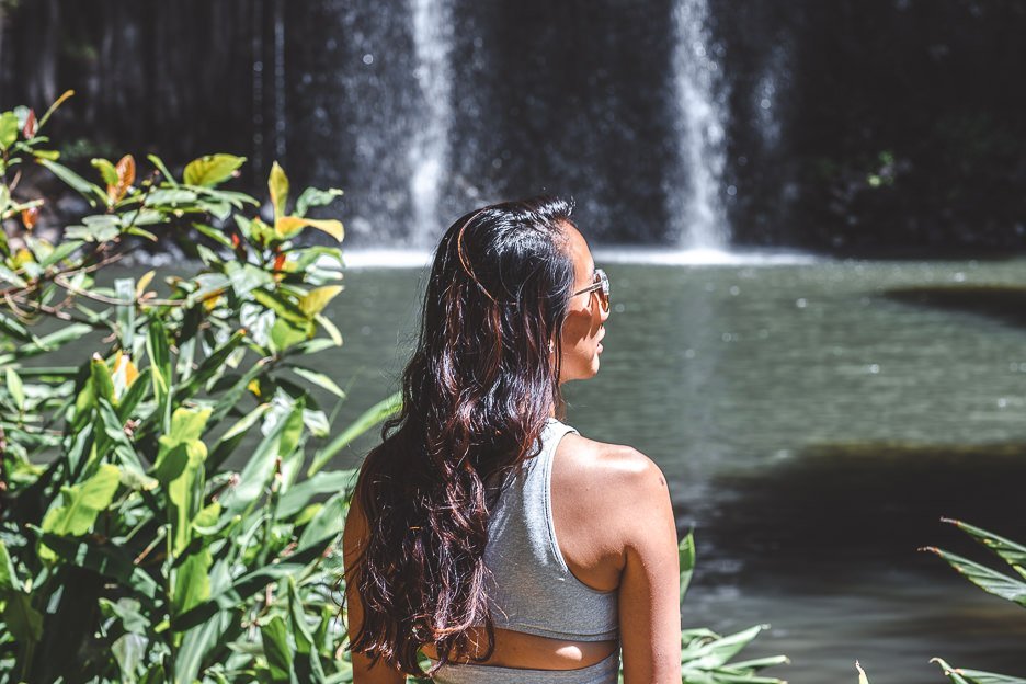
Both tracks meet again below the breathtaking Nandroya Falls which had us both thinking that we had been teleported to Iceland. Jasmine also believed that one of Khaleesi’s dragons could burst through the back of the waterfall at any moment! There are biting sandflies living around the edge of the water and we have also read warnings of leeches and stinging trees.
If you have more time and energy, the Nandroya Falls Circuit joins up with Tchupala Falls Trackhead and possibly on to Crawfords Lookout and the North Johnstone River.
Address
Wooroonoran National Park – accessible from Palmerston Highway
Distance
4.4 kilometres return (short route), 6.6 kilometres (circuit)
Time Required
2 hours (short route), 3 hours (circuit)
Difficulty
Easy
MILLAA MILLAA FALLS
Another one of three waterfalls on the waterfall circuit, Millaa Millaa Falls is super easy to access and a popular swimming hole. A staircase from the carpark will lead you past a set of changerooms before you’re greeted with a perfect curtain of water cascading 18 metres down into the pool below. The grassy picnic area was looking a bit weathered and bare when we visited and we’d expect that it can get quite muddy after some serious rainfall. There is not much shade cover here so don’t forget to slip slop slap.
As with most popular attractions, visit early-ish in the morning or late in the afternoon if you would prefer a quieter experience, sans the bus loads of tourists and backpackers. If you’re fortunate, you might even glimpse a shy platypus!
Address
Millaa Falls Road, Millaa Millaa QLD 4886
Distance
100 metres
Time Required
30 minutes
Difficulty
Easy
Extra Tip:
The township of Millaa Millaa is only 3 kilometres from the waterfall and there is a petrol station there (in case you make the same mistake as us and don’t fill petrol in Innisfail before heading west. There are no other petrol stations between Pin Gin Hill and Millaa Millaa along the Palmerston Highway – you have been warned!
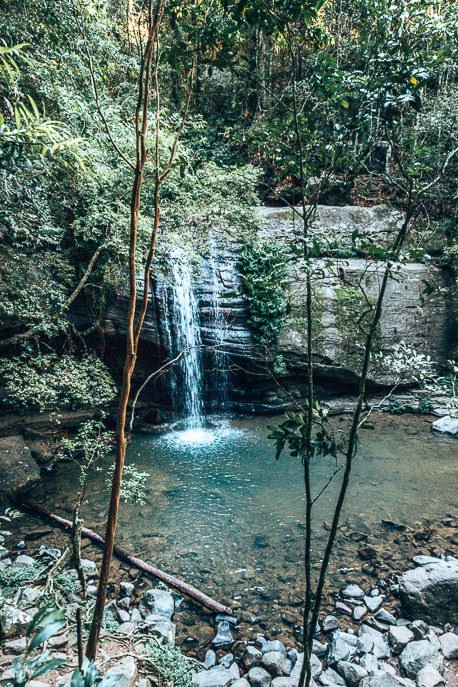
ELLINJAA FALLS
This ledge waterfall is one of three waterfalls located on the 17 kilometre waterfall circuit on the Atherton Tableland. A short walk from the carpark will bring you to the base of the waterfall, a suitable spot for swimming under the shady trees. As the creek bed is rather shallow, it makes Ellinjaa Falls one of the better spots for families with young children who wish to have a little splash about. We didn’t spot any turtles or platypus during our visit but no doubt you’ll bump into the two resident roosters that frequent the carpark.
Address
Theresa Creek Road, Millaa Millaa, QLD 4886
Distance
200 metres
Time Required
30 minutes
Difficulty
Easy
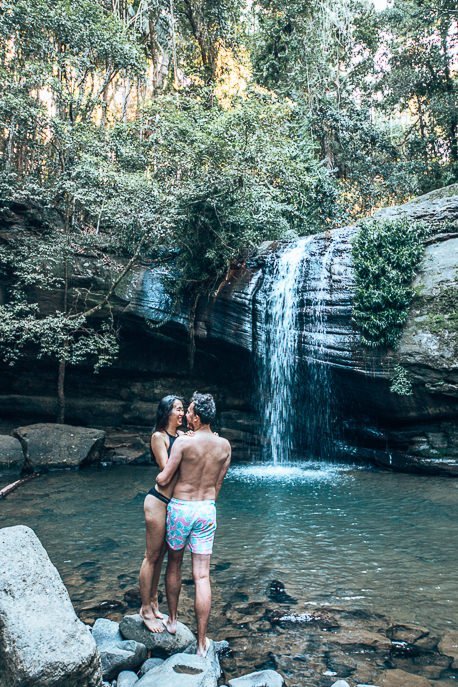
JOSEPHINE FALLS
Another popular waterfall on the Cairns waterfall circuit, Josephine Falls is located 75 kilometres south of Cairns. The multi-tiered cascading falls and swimming hole sit on the edge of Wooroonooran National Park in the shadow of Mt Bartle Frere. Queensland Parks have built some excellent facilities here with paved paths, lookout platforms, toilets and barbeque and picnic areas. There have been reports of snakes lying on the paths sunning themselves so take care of where you walk. We visited late one afternoon and had to deal with a few sandflies. Whether you’re here for a brief visit or for a whole day, ensure you have a go slipping down the natural rock water slide into the crystal clear rock pools. The falls and pools are mostly covered by the rainforest canopy but it always pays to be sun safe.
There are stairs leading down to Middle Creek and the Bottom Pool but access to the top section of the pools is prohibited for safety reasons. Please follow and respect these signs. Hiking and bushwalking fans may want to hike the route from Bartle Frere to Broken Nose (10kms return) or further up to the Atherton Tablelands (15 kilometres one way).
Address
Josephine Falls Walk, Bartle Frere QLD 4861
Distance
700 metres
Time Required
30 minutes
Difficulty
Easy
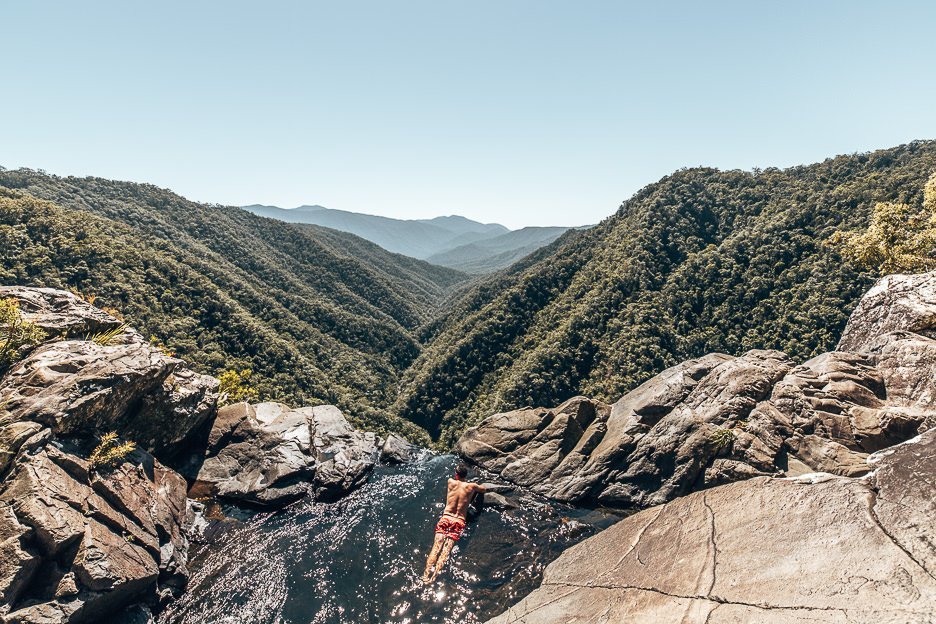
WINDIN FALLS
Out of all the waterfalls we’ve visited in Queensland to date, this one involved the most time and physical exertion to reach. But the views and scenery made it well worth the trip. At the top of Wooroonooran National Park, you’ll drive approximately 30 minutes east of Malanda along Glen Allyn Road. You’ll reach the Old Cairns Track, which is an unsealed road but firm enough for vehicles. Passing the Lamins Hill Lookout, you need to then turn right following the sign pointing towards the Mt Bartle Frere Walking Track. The beginning of the walking track to Windin Falls is not well signed. These are the exact map coordinates for the start of the hiking trail and where you can park your vehicle: 17°21’53.7″S 145°45’01.7″E. There is a broken sign here pointing towards Mt Bartle Frere Walking Track – ignore this if your destination is Windin Falls.
The walk itself is not too strenuous as the entire trail is evident and the gradients are moderate. The track is covered in leafy debris, pine needles and the odd tree roots so take particular care after any rain in case the ground is slippery in sections. It took us 90 minutes to reach the infinity pool at the top of the waterfall; we would allow for the same amount of time for the return journey.
Accounts from other hikers speak of muddy sections from recent rainfall, leeches and even encounters with a juvenile cassowary! Our experience on a bright, dry October morning included none of these, but we did run into plenty of biting sandflies once we reached the pool. There were no sandflies during the hike. Take the time to soak up the spectacular views of the forest and valley below and take a dip in the cool, refreshing water. Take heed to not swim too close to the edge!
Address
Old Cairns Track, Butchers Creek QLD 4885
Distance
11 kilometres return
Time Required
4 – 4.5 hours (depending on how long you spend swimming at the pool and your breaks during the hike)
Difficulty
Moderate/Difficult
TWIN FALLS
Twin Falls sits within Springbrook National Park which is located on the Gold Coast approximately 1.5 hours drive south of Brisbane. There are many breathtaking waterfalls, hiking trails, scenic lookouts and ancient trees in Springbrook which is part of Gondwana Rainforests of Australia World Heritage Area.
Start the Twin Falls circuit from the Tallanbana picnic area or Canyon lookout. If you follow the trail in an anti-clockwise direction, you will be guided by interpretative signs detailing the different forest types you pass through. This part of Springbrook National Park is particularly special as it is home to Lophostemon confertus brush box trees, known for its signature smooth, pink bark. Samples of these brush box trees have been radio-carbon dated at 1,500 years old – making these trees the oldest carbon-dated species on Australia’s mainland!
The trail is moderate with only a few flights of stairs and steady inclines and declines (depending on which way you complete the circuit!) along the entire marked trail. There is also plenty of tree coverage providing ample shade.
Important Note! Swimming is not permitted at the base of the falls and there is a clear sign stating so. This is to prevent damage to the native flora and fauna. Please respect the instructions and tread carefully in this National Park.
Address
Springbrook National Park, Springbrook QLD 4213
Distance
4 kilometres return (Twin Falls Circuit)
Time Required
2 – 2.5 hours
Difficulty
Moderate
BUDERIM FALLS/SERENITY FALLS
Buderim Falls, otherwise known as Serenity Falls, is tucked away in Buderim Forest Park only a kilometre from Buderim Village and 15 minutes drive from the coast. The 45 hectare oasis includes a rainforest, marked trails and BBQ picnic areas. There are two entry points: the lower entry is off Lindsay Road via Harry’s Lane and the other is via Quorn Close where you’ll find the most parking and is closest to the falls. It’s a shallow pool at the bottom of the falls but the water isn’t always clear so take care of where you step should you choose to swim here. The canopy provides plenty of shade so even on a blistering hot day, you can find some respite from the heat.
Address
Buderim Forest Park, Quorn Close, Buderim QLD 4556
Distance
50 metres (Quorn Close) or 600 metres (Lindsay Road)
Time Required
30 minutes – 1 hour
Difficulty
Easy
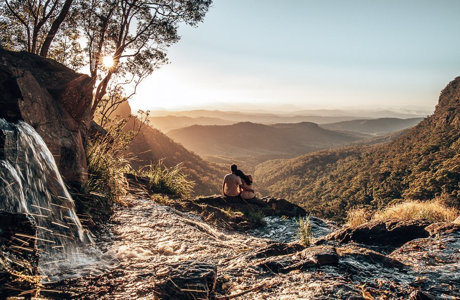
MORAN FALLS
For those staying in the Gold Coast area, Moran Falls is a moderate rainforest hike which can easily be completed with a day trip visit to O’Reilly’s Rainforest Retreat. It is a subtropical rainforest area and the entire trail is marked up to the point where you reach the boulders and you’ll know you’re close to the top of the falls. Carefully make your way along the riverbank here as the trail somewhat disappears a bit and it will depend on how much rainfall there has been before your visit.
There is a lookout at the top of Moran Falls which gives wonderful views over Moran Gorge and is the perfect stop for a picnic. We timed our visit with sunset and were treated to a beautiful, warm golden glow. If you do decide to stay for sunset, please ensure you pack a torch and jacket to navigate your way in the darkness on the return trip and do not walk alone!
Address
Lamington National Park, Moran Creek Rd, Fairyland QLD 4413
Distance
4.4 kilometres return (start and end point are the same)
Time Required
2 hours
Difficulty
Moderate
STILL CHASING? OTHER WATERFALLS IN QUEENSLAND
Close To… Cairns
- Zillie Falls | Ellinjaa Falls Theresa Creek Road, Millaa Millaa, QLD 4886
- Tully Falls | Tully Falls National Park, Koombooloomba QLD 4872
Close To… Cape York
- Fruit Bat Falls | Heathlands Regional Park, Shelburne QLD 4874
- Eliot Falls | Heathlands Regional Park, Shelburne QLD 4874
Close To… Gold Coast
- Purling Brook Falls | Springbrook National Park, Forestry Rd, Springbrook QLD 4213
Close To… Sunshine Coast
- Kondalilla Falls | Kondalilla Falls Road, Montville QLD 4560
Close To… The Whitsundays
- Cedar Creek Falls | Cedar Creek Falls Road, Cedar Creek Reserve, Cedar Creek QLD 4800
MORE INFORMATION
For more information about Queensland’s National Parks, visit this website.
Gone chasing waterfalls in Queensland? Tell us your favourites!
LIKE THIS POST? PIN IT AND SHARE IT!