A road trip through tropical north Queensland means days chasing waterfalls, meandering under rainforest canopies and searching for secluded coves along the winding coastline.
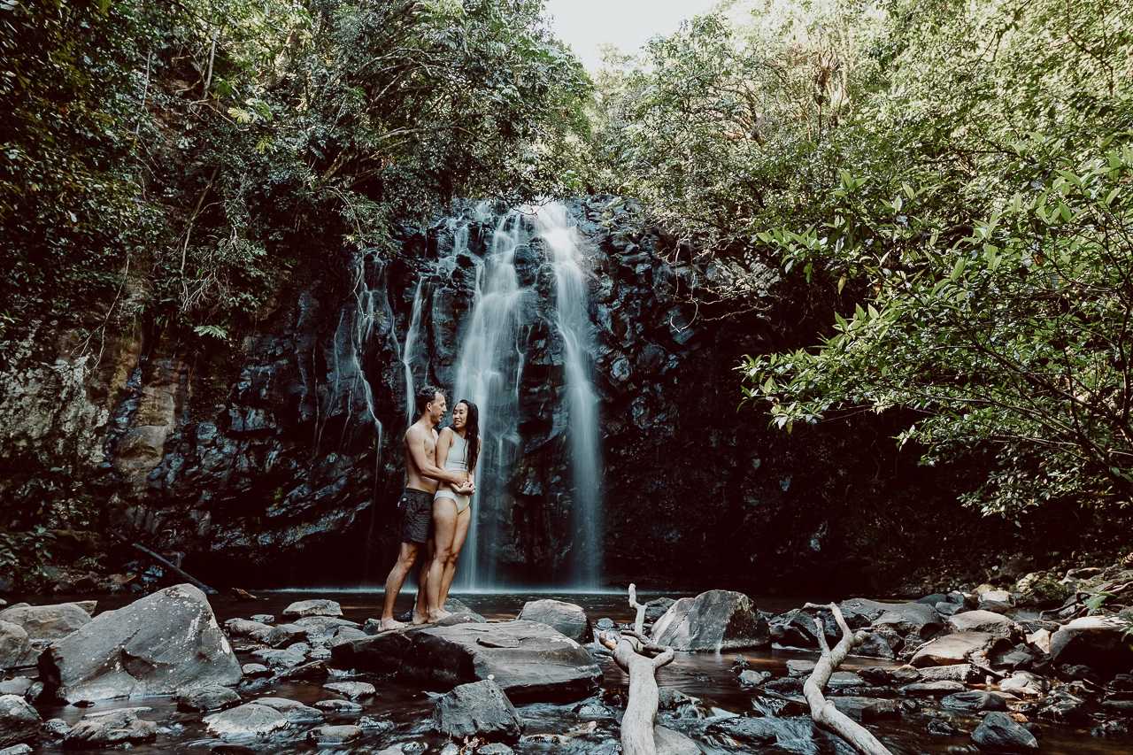
Fortunately, some waterfalls and swimming holes are easier to reach than others and thankfully, Josephine Falls falls into this category. Located on the edge of Wooroonooran National Park, we were fortunate to visit Josephine Falls during our 5 day campervan trip of tropical north Queensland.
In this blog post, we provide comprehensive information on the Josephine Falls location, how to get to Josephine Falls and how to visit safely.
Share
JOSEPHINE FALLS | LOCATION & HOW TO GET THERE
Josephine Falls Quick Facts
Opening Times/Seasons: All day/ All year
Entrance Fee: Free
Can you swim at Josephine Falls? Yes. There are no crocodiles at Josephine Falls!
Can you camp at Josephine Falls? No
Toilets: Yes
Picnic tables: Yes
BBQ: No
Where is Josephine Falls?
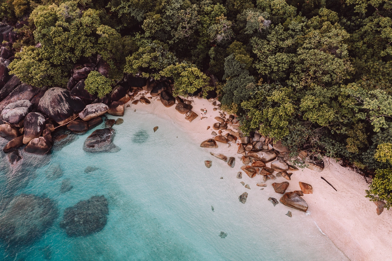
Josephine Falls is located on the south east end of Wooroonooran National Park in tropical north Queensland. The closest towns are Innisfail and Babinda.
The great thing about Josephine Falls is that it is easily accessible with a designated car park and paved pathway which leads to viewing platforms and swimming holes at the bottom of the cascading falls.
How To Get To Josephine Falls
How To Get To Josephine Falls from Cairns
Josephine Falls is just over one hour drive from Cairns, 75km south along the Bruce Highway. After Miriwinni, take the Bartle Frere Rd turnoff towards Wooroonooran National Park and follow the signs to Josephine Falls.
If you’d prefer to leave the driving to somebody else, then a day trip from Cairns is a great option.
How To Get To Josephine Falls from Townsville
Driving north, direct from Townsville to Josephine Falls would take around 3 hours 30 minutes along the Bruce Highway. We would recommend breaking up the journey, stopping off at sites including Wallaman Falls and Mission Beach if your itinerary allows you the time.
How long is the Josephine Falls hike?
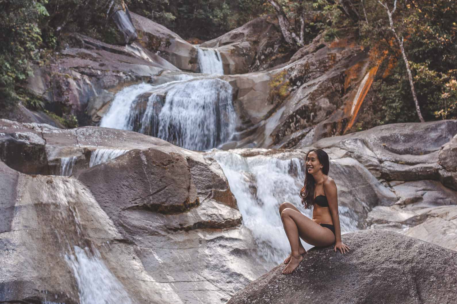
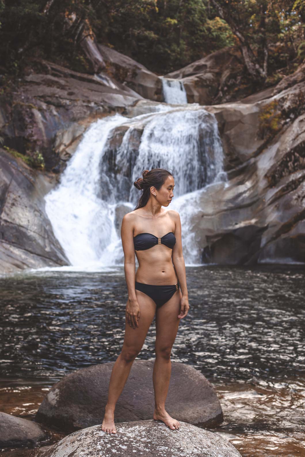
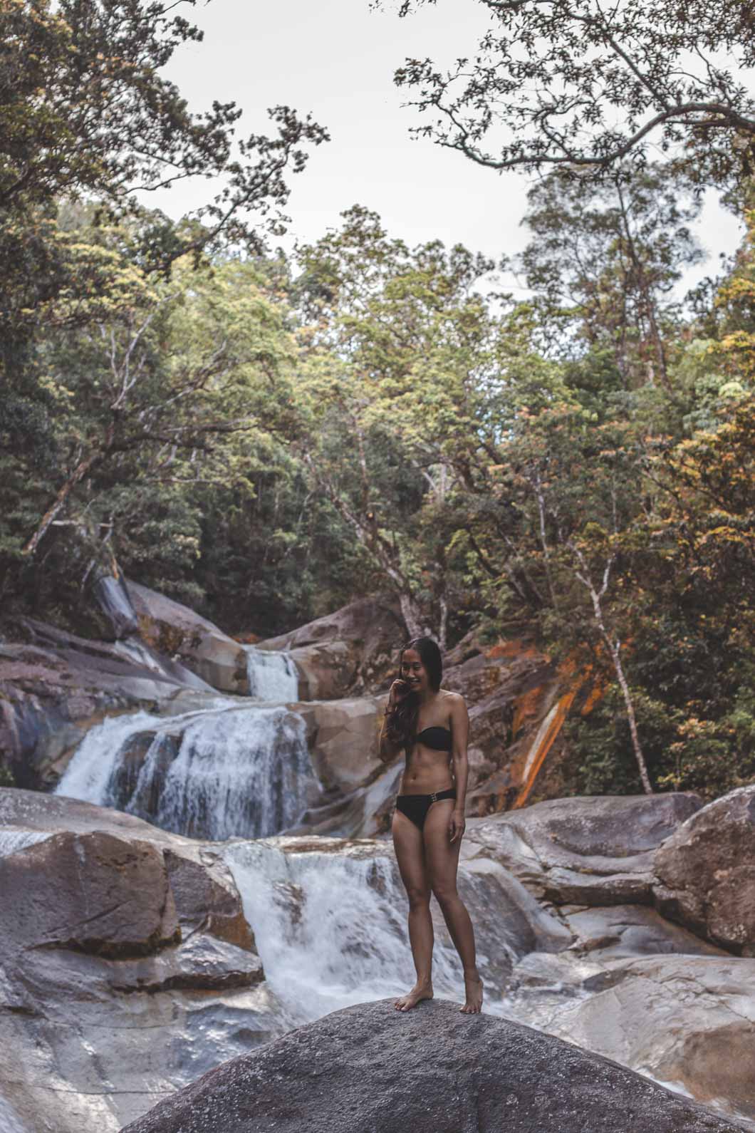
The Josephine Falls hike is more like a stroll underneath a rainforest canopy. From the carpark, it is a mere 1.2 kilometres along a paved pathway which leads to various viewing platforms and different access points to the swimming areas. There are also picnic tables and public toilets located in the carpark.
Access to the upper level and top pool is prohibited. Please respect the signs and do not venture into this area for safety reasons. Visitors are permitted to swim in the middle creek and bottom pool; paved stairs lead down to these swimming areas. The viewing platforms also provide wonderful vantage of the water cascading down over the granite boulders.
For experienced hikers, there are longer trails in the area. The Bartle Frere trail to Broken Nose walking track is 10km return. Allow yourself 8 hrs walking time to complete this section and ensure that you are hiking during daylight hours if you don’t plan on camping. For those with more time, the Bartle Frere Trail – Josephine Falls to Atherton Tablelands is 15kms one way. This hike takes two days to complete.
Both of these hikes are rated difficult and contain steep ascents. They require a high level of fitness plus the correct preparation before commencing. If you are following a short itinerary and do not have appropriate equipment, we would caution against attempting these trails.
Safety Tips for Visiting Josephine Falls
If you are planning on swimming at Josephine Falls then you’ll need to pay attention to the warning signs which will direct you to the safe areas to swim. Whilst you won’t find any crocodiles lurking in the water (at least not the dangerous kind), the area can be dangerous with water moving rapidly and the potential for drowning, particularly small children.
We have read accounts of a natural waterslide which the cascading waterfalls naturally created. We ourselves didn’t swim in this section of the falls but we expect that the waterfall will be more dangerous after some rainfall and conditions can become unpredictable. Be mindful to take care around the rocks as they may be slippery and it would be prudent not to dive into the water as the swimming holes may not be as deep as you think.
There are signs at the highest waterfall overlooking the most upper waterfall advising visitors not to breach the barrier. This is for your safety and we would advise you to pay attention and respect these signs established here by Queensland Parks.
It wouldn’t be Australia if we didn’t mention snakes. Keep an eye out for the serpents that live in this area and which you may find sunning themselves on the paved pathway.
What do I need to hike to Josephine Falls?
To ensure a safe and enjoyable visit, always bring:
Hiking boots | We recommend sturdy, reliable footwear for any hiking but in this case, trail shoes or runners would suffice.
Basic first-aid kit | Including a space blanket
Reusable water bottles | We would suggest taking one with a filter such as this Grayl water bottle
Adequate drinking water | Unfortunately the water in the area is not suitable for drinking. Bring a sufficient amount for a day’s walk and then extra!
Biodegradable wet wipes | In case you haven’t been able to have a shower!
Hat, sunscreen, sunglasses and insect repellent
Adequate clothing for all weather conditions including rain
Swimsuit & microfibre towel if you plan on swimming
Fully charged mobile phone | Mobile phone coverage is limited. Telstra seems to work best out here.
Torch or headlamp | For when nature calls in the middle of the night!